|
Metairie (Images of America) |
|
|
The 17th Street Canal |
||
|
|
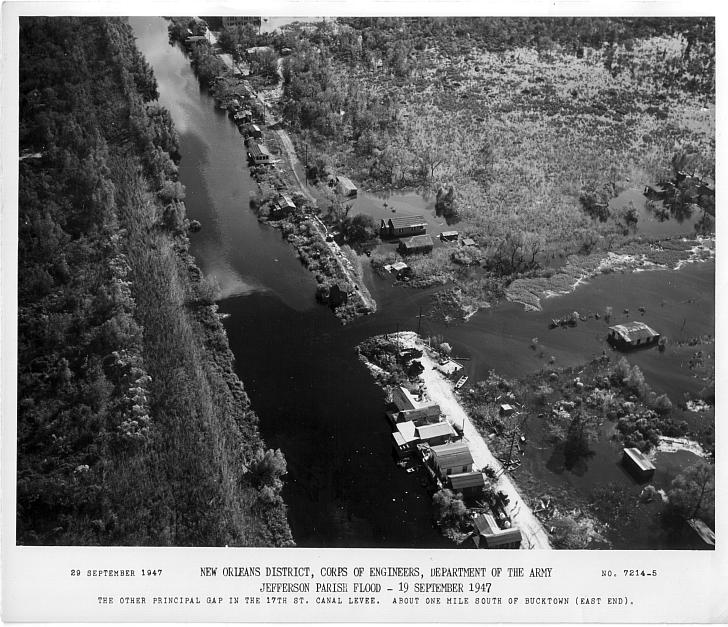 This photograph was taken by the U.S. Army Corps of Engineers on September 29, 1947 after a hurricane resulted in a breach in the 17th Street Canal levee. The caption reads, “Jefferson Parish Flood…The other principal gap in the 17th Street Canal levee. About one mile south of Bucktown (East End)”. Several other breaks occurred; 30 square miles of Jefferson Parish and 9 square miles in New Orleans flooded. (Courtesy of the New Orleans Public Library.) 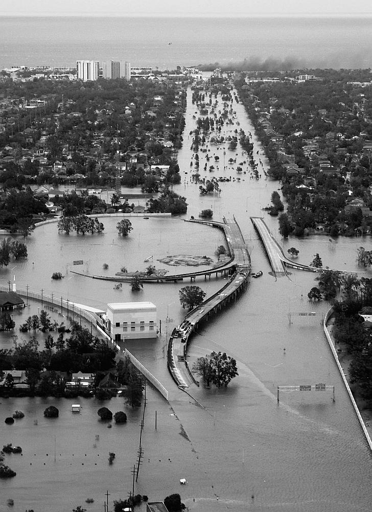 Previous East End area floods resulted from an 1856 hurricane which brought 6 feet of water to the area as well as hurricane related floods in 1893 and 1915. Pictured is Bucktown (upper left) in the days following the 2005 post-Katrina break in the 17th Street Canal. (Courtesy of the U.S. Coast Guard.)
|
|
|
|
||