|
Metairie (Images of America) |
|
|
Sauve Crevasse - 1849 |
||
|
|
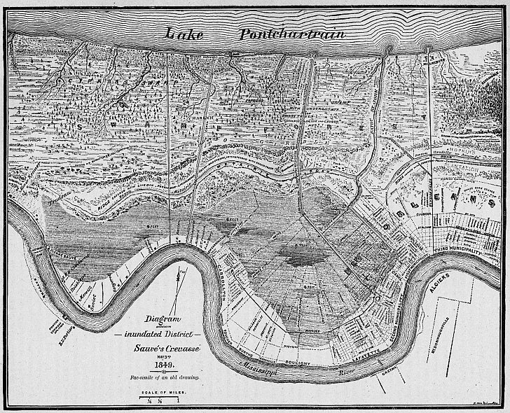 This map of the Sauve Crevasse has become well known post-Katrina because the floods of 1849 so closely duplicated the
results of the floodwall and levee breaks immediately following Hurricane Katrina. Various natural bayous in Metairie (now
filled) fed by the lake can be seen here including Double Bayou, Bayou Luria, Bayou Tchoupitoulas and Indian Bayou (just right
of center near the top) with its shell bank (also known as Indian Beach). Indian Beach still appears on many modern maps.
It was located in what we now call Bucktown at Bonnabel Boulevard. By 1886, when this map was produced two canals (left of
center) had been dug and can be seen here running north to south.. Bayou Metairie, Metairie Road, and Metairie Ridge run east
to west from Bayou St. John to Kenner. (Courtesy of the University of Tennessee Library)
|
|
|
|
||