|
Metairie (Images of America) |
|
|
Sauve, Soniat, and Labarre |
||
|
|
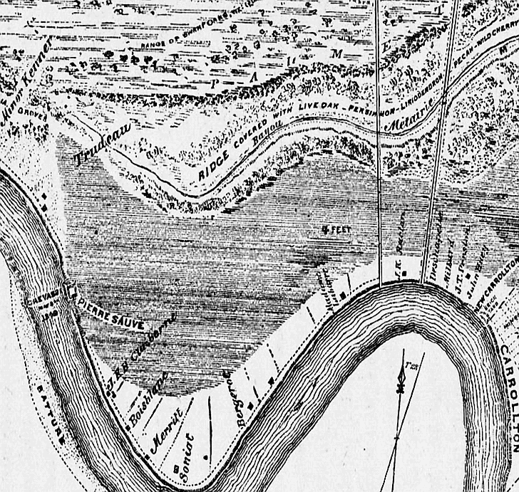 To the far left (above) is the land deeded to Minor Kenner (with a Magnolia Grove) that would become the city of Kenner.
Louis Trudeau’s abuts Kenner’s property. Pierre Sauve owned the land where the crevasse occurred. Other land owners
whose names are still familiar to local residents include Soniat and Labarre. The New Carrollton and Carrollton areas can
be seen on the far right. In this Sauve’s Crevasse map detail below the Metairie and Gentilly Ridges can be viewed (running
east to west) as they converge at Bayou St. John. The Carrollton and Lafayette sections (bottom) as well as the faubourgs
between them (which would become the city of Jefferson) were annexed from the Parish of Orleans when Jefferson Parish was
established in 1825. (Courtesy of the University of Tennessee).
|
|
|
|
||