|
Metairie (Images of America) |
|
|
The Old Hammond Highway |
||
|
|
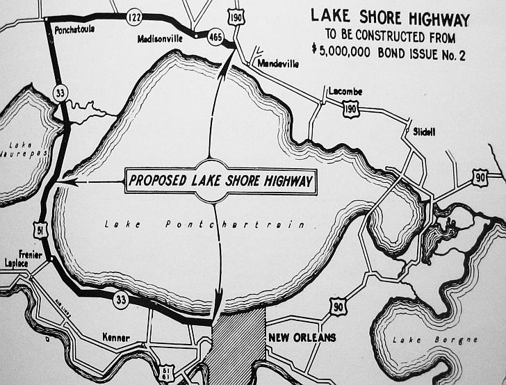 A highway along the south shore of Lake Pontchartrain from Orleans to St. Charles Parish was proposed during the 1930s. In 1955 the plan was still under consideration and included four lanes with service roads and park/play areas but a small section of the road had been built in Metairie. Other proposals that never left the drawing board included the expansion of Metairie Road to four lanes and the widening of Loumor Avenue from the parish line to Labarre Road to four lanes. Below is a 1930s view of the first link (in Metairie) of the proposed New Orleans-Hammond Lakeshore Highway. Although it was never completed, the continuous erosion of this link led (by the mid 1940s) to the awareness of the need for flood protection as the area developed and expanded. (Courtesy of the Jefferson Parish Yearly Review.) 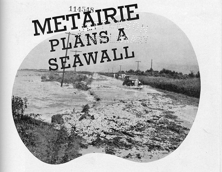
|
|
|
|
||