|
Metairie (Images of America) |
|
|
Orleans/Jefferson Parish Boundary Changes |
||
|
|
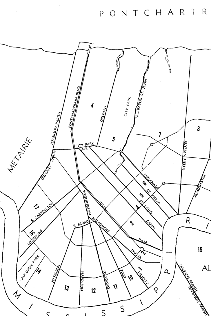 Compare this view of the parish boundary in 1880 and note that the northernmost line has shifted
from Pontchartrain Boulevard to the 17th Street Canal. This accounts for the West End area often being referred
to, though the early part of the twentieth century, as “East End” (the eastern end of Jefferson Parish). The
lower parish line has swung dramatically to the west. The City of Carrollton, Jefferson City, and Lafayette City have been
returned to New Orleans. (Courtesy of the New Orleans Public Library)
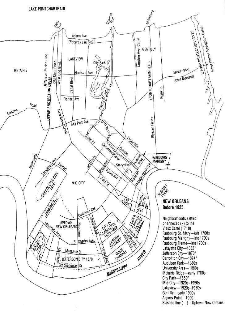 This diagram lists areas as they were settled or annexed to New Orleans. Lafayette City was
returned to Orleans Parish in 1852. Jefferson City was annexed from Jefferson Parish in 1870. Carrollton City was removed
from Jefferson Parish four years later. Note that Mid-City and Lakeview did not begin to develop until the 1920s –
they are newer than the older parts of Metairie. (Courtesy of the New Orleans Public Library.)
|
|
|
|
||