|
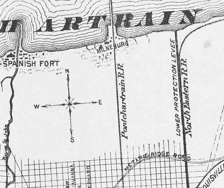
This 1893
map segment includes views of the locations of Spanish Fort/Bayou St. John, Milneburg, and the Little Woods area along
the New Orleans lakeshore. The Lower Protection Levee in what is now called New Orleans East is seen on the left. Also
included are the Pontchartrain Rail Road and North Eastern Rail Road routes as well as Metairie RIdge Road -- which is
not most often Called the Gentilly Ridge.
 |