|
New Orleans Maps |
|
|
1850 Jefferson City
|
|||||||||||||||||||||||||||||||||||||||||||||||||||||||||||||||||||||||
|
Site Map
|
Established
in 1890, the Jefferson City Buzzards is the oldest New Orleans Carnival marching club. Their five mile route from headquarters
at 5801 Tchoupitoulas Street ends on Poydras Street. At Canal Street they precede the Rex parade. Before the area was incorporated
as the Jefferson Parish city of Jefferson it was known as the Faubourg Bouligny, named for the plantation owner Louis Bouligny.
When the area was subdivided some streets were named for Napoleon's victories; Austerlitz, Jena, Valence, Cadiz, and Marengo.
Napoleon Avenue was one of its major streets. Jefferson City included what we now call Uptown New Orleans. Pictured are the
Jefferson City Buzzards marching in 1925. 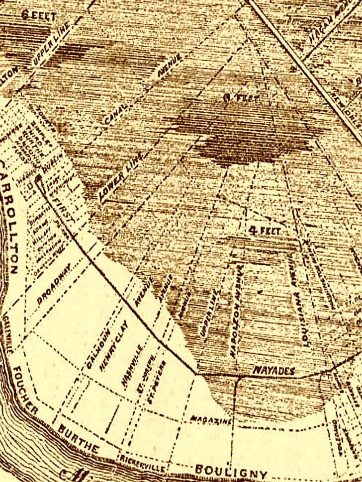
|
|
|||||||||||||||||||||||||||||||||||||||||||||||||||||||||||||||||||||
|
|
|||||||||||||||||||||||||||||||||||||||||||||||||||||||||||||||||||||||