|
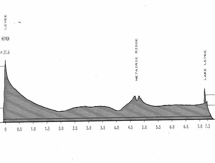
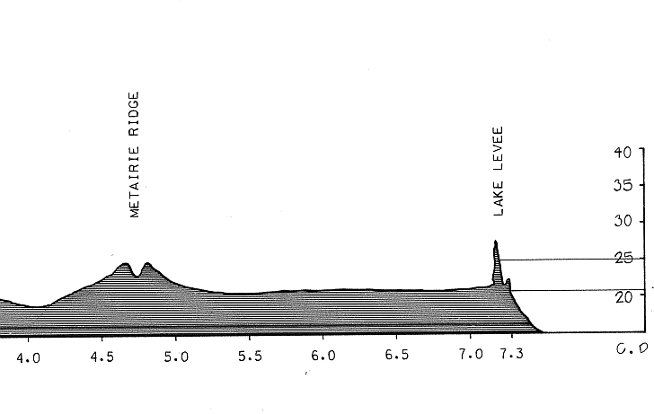
Contrary to modern folklore most streets in the metropolitan New Orleans area do not lay below sea level but rainwater
must be mechanically removed from the streets because the surrounding Lake Pontchartrain and the Mississippi River tides often
rise above street level. This problem is compounded by natural occurring and man-made levees which prevent flooding but also
trap water in the streets in the event of an overflow or heavy rainfall. Bayou Metairie contributed to the topography as it
would (like the lake and river) regularly rise; overtop its natural borders, and fall leaving deposits of soil and sand to
build up over time. This diagram illustrates the situation. (Courtesy of the Louisiana State University. School of Landscape
Architecture. Office of Sea Grant and the Library of Congress.)
 |