|
New Orleans Maps |
|
|
1849 Orleans/Jefferson Parish Boundaries
|
|||||||||||||||||||||||||||||||||||||||||||||||||||||||||||||||||||||||
|
Site Map
|
In this map detail the New Basin canal (also called
the New Orleans Canal), runs north to south and terminates at West End on the lake. It acts as the boundary between Orleans
and Jefferson Parish until it veers to the right near the center of the map. From that point the boundary line extends toward
Felicity Street to the river (bottom right corner). The present Pontchartrain Expressway and Pontchartrain Boulevard now follow
the path of the canal which was covered during the 1950s. West End as well as land west of Felicity Street was within the
Jefferson Parish boundary when the parish was created in 1825. The current boundaries were set in 1874. (Courtesy of the University
of Tennessee). 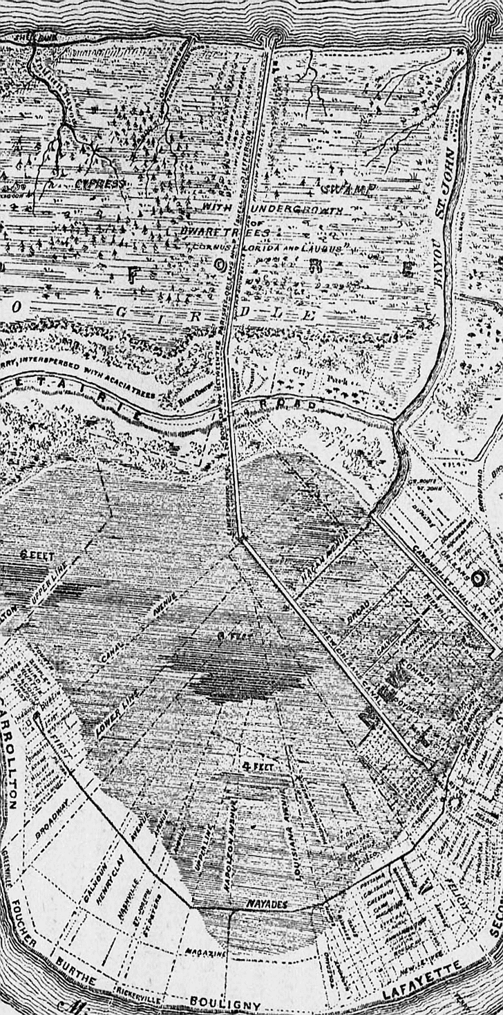
|
|
|||||||||||||||||||||||||||||||||||||||||||||||||||||||||||||||||||||
|
|
|||||||||||||||||||||||||||||||||||||||||||||||||||||||||||||||||||||||