|
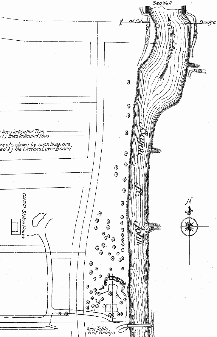
This section of a 1934 Survey of Historic American Buildings includes a view of the new seawall and reclaimed land as
well the outline of streets “proposed by the Orleans Levee Board”, The “Old RR [railroad] Station House”
(right), the fort (bottom center), and a “Turn Table Foot Bridge” crossing the bayou (bottom).
 |