|
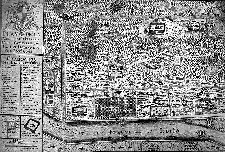
Le Page du Pratz “proceeded to the Bayouc Choupic [Bayou Metairie] so denominated from a fish of that name abounds
not only with sea fish but with fresh water fish, some of which, particularly carp, would appear to be of a monstrous size
in France. We entered this Creek Choupic: at the entrance of which is a fort at present [included in this illustration]. We
went up this creek for the space of a league, and landed at a place where formerly stood the village of the natives, who are
called Cola-Pissas...that is, the nation of men that hear and see. From this place to New Orleans, and the river Missisippi,
on which that capital is built, the distance is only a league”.
 |