|
New Orleans Maps |
|
|
1924 Old Metairie
|
|||||||||||||||||||||||||||||||||||||||||||||||||||||||||||||||||||||||
|
Site Map
|
The first of Metairie’s designated subdivisions are seen in this 1924 map. Metairie Ridge is unmarked here but includes
the streets above Metairie Road along the New Orleans/Jefferson Parish line. The area around the Vincent property would become
Metairie Club Gardens. The Thompson property included a miniature and a full-sized golf course. The Peters property later
became Cottam Park. The Crestmont and Beverly Knoll subdivisions appear near the bottom left. Bonnabel Place is unmarked but
its streets include those north of Codifer Boulevard. West of Nursery Street in the large undeveloped area of this map was
an area known to locals as Hog Alley. (Courtesy the Library of Congress.) 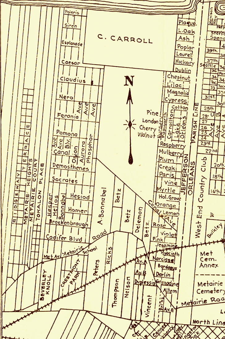
|
|
|||||||||||||||||||||||||||||||||||||||||||||||||||||||||||||||||||||
|
|
|||||||||||||||||||||||||||||||||||||||||||||||||||||||||||||||||||||||