|
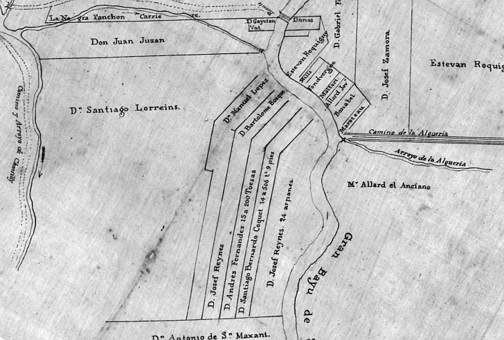
Five years after New Orleans was founded, the land which would be City Park was deeded to Francisco Hery in a 1723 French
colonial concession. Some fifty years later, during Spanish rule, his widow sold the property to Don Santiago Loreins who
would leave it to his daughter and son-in-law, Jean Louis Allard. The 1819 Spanish map above shows Allard's land (left of
center), Bayou St. John (“Gran Bayu de sn Juan”), Bayou Metairie (“Arroyo de la Alqueria”), and Metairie
Road (“Camino de la Alqueria”). Below is a modern map showing approximately the same area.
 |