John McDonogh died in 1850 – much of his bequest was used to build schools but a portion of his property was set
aside for City Park. The 4th District Court's 1854 designation of approximately 100 acres of the property as a public park
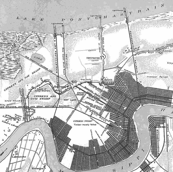
makes it one of the oldest in the nation. This 1863 map of Civil War fortifications shows City Park in the center, relatively
isolated from the city.
Military installments included here are Fort Banks on the West Bank, Camp Parapet
on what is now Causeway Boulevard in Old Jefferson, the Depot of Army Stores in what is now Old Metairie, a fortification
at what is now the cemeteries area at Canal and City Park Avenue, and forts along Bayou St. John, Elysian Fields
near Gentilly Road, and on Bayou Sauvage (aka Bayou Gentilly).