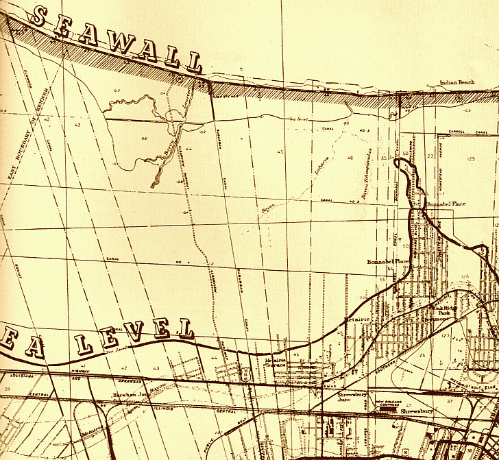
|
S. V. Applewhite composed this map of ground elevations during the late 1940s. By 1949 a seawall was being constructed
along Metairie’s lakeshore. The majority of the area aside from Bucktown and Old Metairie has yet to be developed. The
proposed extension of Clearview Parkway from what is now West Napoleon Avenue to the lake runs north to south just left of
center. Canals running north to south include Soniat, Elmwood, Suburban (with a pumping station), Bonnabel, and Homestead.
Three bayous still existed; Bayou Laurier, Bayou Labarre, Bayou Tchoupitoulas (all flowing north to south from near the lake).
Subdivisions identified on this map include Metairie Terrace, Bonnabel Place, Crestmont, and Oak Ridge Park. Metairie Club
Gardens and the Metairie Golf Course can be seen near the bottom right. (Courtesy of the Jefferson Parish Yearly Review.)
 |