|
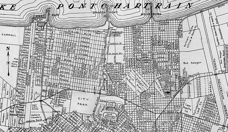
This 1924 map illustrates the early streets in Bucktown and Old Metairie properties as well as now defunct
places including West End Country Club, the New Basin Canal (aka New Orleans Navigational Canal). the Wireless Station (now
WYES public television station) adjacent of City Park at Navarre Road, and the lost amusement and resort areas
of West End, Spanish Fort, and Milneburg. A section of Robert E. Lee Avenue ran along the Lake Pontchartrain (before
land reclamation left it some distance from the shore) and Mount Carmel Academy students could view the lake from their classrooms.
City Park's boundaries, at this time, were Florida Avenue, Orleans Avenue, City Park Avenue, and Bayou St. John. By the
end of the decade the park had grown to include more than 900 additional acres for a total land- spread from from City
Park Avenue to what was then the Lakefront at Robert E. Lee Boulevard. Former dairy-land and marsh owned primarily by the
New Orleans Land Company it would be converted into streets, lagoons, and golf courses.
 |