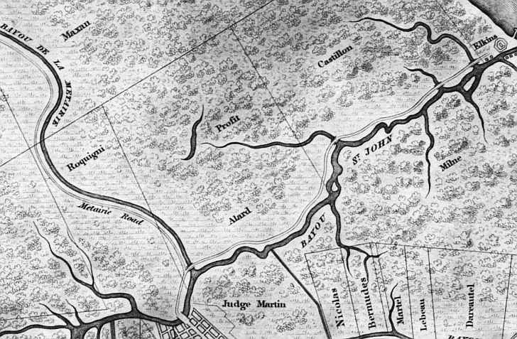
This 1828 map shows the Allard Plantation property (lower center), as well as Bayou St. John flowing to Lake
Pontchartrain (where a port with a lighthouse and Harvey Elkin's popular Spanish Fort Resort were thriving), Metairie Road,
Bayou Metairie, and Alexander Milne's property (which would soon boom as the Pontchartrain Railroad's Smokey Mary began its
run in 1831) east of the Bayou St. John to the lake.
Other land owners at this time included Maxan, Roquigni, Profit,
Martin, Castillon, Elkins (who developed the Spanish Fort amusement area), Bermudes, Martel, Le Beaud, and Dareautel.