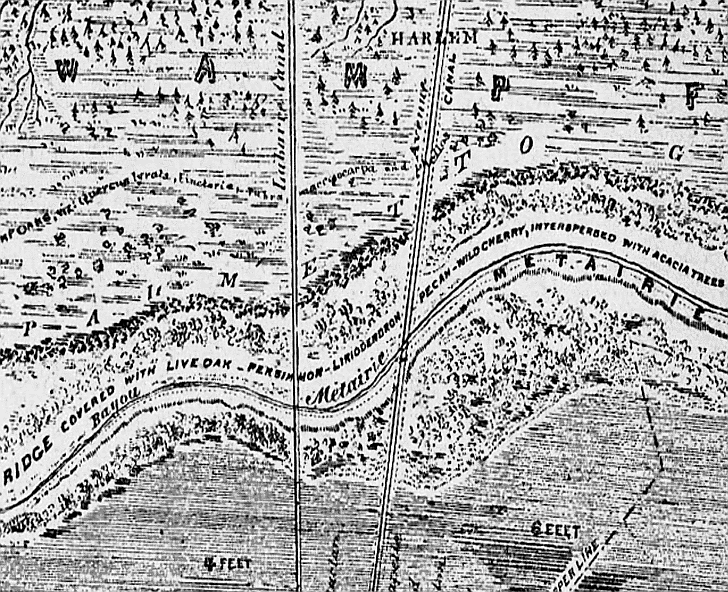
Near the top center of this map detail can be seen the Harlem district which now includes Shrewsbury and Causeway Boulevard.
Until the mid-twentieth century Causeway Boulevard was named Harlem. The map notes “Ridge covered with live oak –
persimmon – wild cherry, interspersed with acacia trees”. Four to six feet of standing water south of Metairie
Road occured in the 1849 Mississippi River flood known as the Sauve Crevasse -- which closely parallels the post-Katrina flooding.
The Sauve Crevasse has become well known post-Katrina because the floods of 1849 so closely duplicated the results
of the floodwall and levee breaks immediately following Hurricane Katrina. Various natural bayous in Metairie (now filled)
fed by the lake inclded Double Bayou, Bayou Luria, Bayou Tchoupitoulas and Indian Bayou with its shell bank (also
known as Indian Beach). Indian Beach still appears on many modern maps. It was located in what we now call Bucktown at Bonnabel
Boulevard. By 1886, when this map was produced two canals (left of center) had been dug and can be seen here running north
to south.. Bayou Metairie, Metairie Road, and Metairie Ridge run east to west from Bayou St. John to Kenner.