|
New Orleans Maps |
|
|
1867 Metairie Race Course
|
|||||||||||||||||||||||||||||||||||||||||||||||||||||||||||||||||||||||
|
Site Map
|
The oval shape below the center of this detail from an 1867 map is the Metairie Race Course. It was first named Bingaman
Course for the Natchez farmer/horse owner Colonel Adam L. Bingaman. The land was acquired from the N.O. Canal and Banking
Company in 1838. Ten years later it was turned over to Richard Ten Broeck who established a joint-stock company with full
control of the course. In 1851 the grandstand was refurbished. Special stands and parlors “for the ladies” were
added, making the track a popular venue for all. Metairie Race Course was one of the south’s leading tracks. The course
was so popular that the nearby Union track (later to be named the Fair Grounds) was unable to compete successfully and closed
from 1857 to 1859; it was purchased by the Metairie Trotting and Pacing Club and renamed the Creole Race Course. The land
containing the Metairie Race Course was converted into Metairie Cemetery in 1873. (Courtesy of the Louisiana Digital Library.) 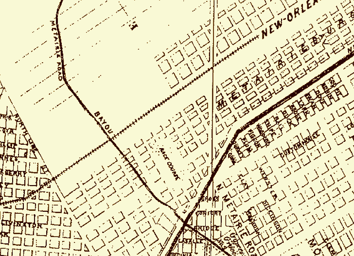
|
|
|||||||||||||||||||||||||||||||||||||||||||||||||||||||||||||||||||||
|
|
|||||||||||||||||||||||||||||||||||||||||||||||||||||||||||||||||||||||