|
New Orleans Maps |
|
|
1849 Bayou Tchoupitoulas
|
||||||||||||||||||||||||||||||||||||||||||||||||||||||||||||||||||
|
|
In 1885 Norman Walker wrote, “On bayou Tchoupitoulas, which courses through the suburbs of the city, emptying
into Lake Pontchartrain, are to be found relics of the old Indian town Tchou-tchouma, or “the city of the sun,”
which antedated by countless centuries “the Crescent city.” Here are primeval shell-mounds and Indian burial-grounds,
still well-stored with prehistoric bones, the re-mains, perhaps, of some feast of those Louisiana cannibals, the Attakapas
(man-eaters), of whom the French settlers were so much in dread. Walker was describing another bayou named Tchoupitoulas that
flowed in what is now the Causeway/lakefront area. A detail from an 1849 map shows the Bayou Tchoupitoulas which
Walker described above. East of th.is bayou, Indian Bayou and a shell bank can be seen. The land shown here now includes the
Causeway and Bucktown areas. 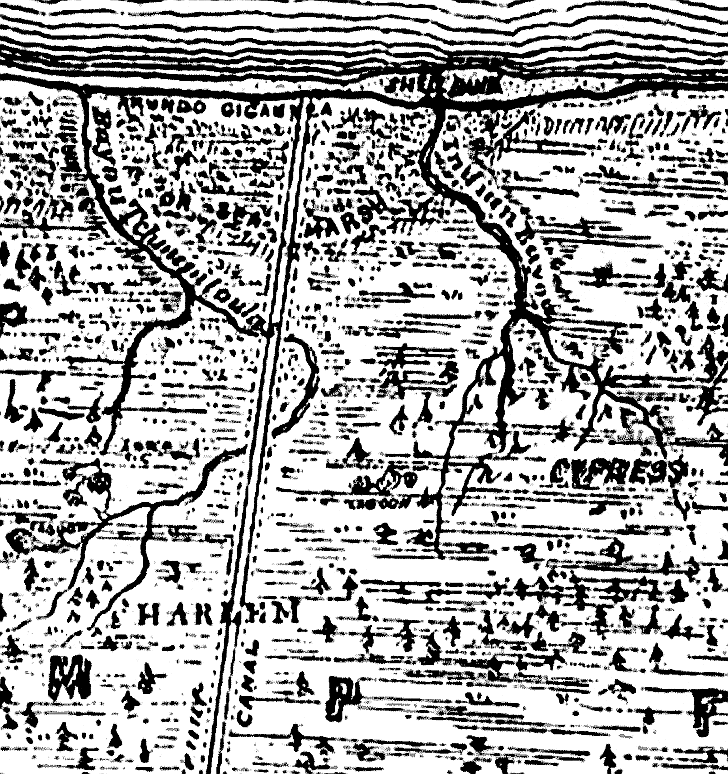
|
|
||||||||||||||||||||||||||||||||||||||||||||||||||||||||||||||||
|
|
||||||||||||||||||||||||||||||||||||||||||||||||||||||||||||||||||