|
New Orleans Maps |
|
|
1924 Bucktown & East/West End
|
|||||||||||||||||||||||||||||||||||||||||||||||||||||||||||||||||||||||
|
Site Map
|
By 1886 Bucktown/East End had many bars and restaurants, accessible via the Carrollton Railroad and the steamer Virginia
which traveled to and from Mobile, and many of the current streets had been laid out. During the late 1800s and early 1900s
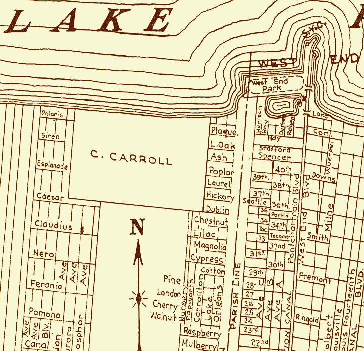
Bucktown was known for its gambling houses and brothels. This 1924 map section shows the streets existing in this area at
that time. In 1859 Theodore Bruning moved his Carrollton restaurant to Buctown/East End. There were no levees and roads
flooded from September to April so Mr. Bruning opened his doors from Easter Sunday until Labor Day of each year. In 1886 Bruning’s
moved to the location it remained in until Hurricane Georges badly damaged it in 1998. The restaurant moved to an on-land
building next door where Bruning’s served seafood until Hurricane Katrina destroyed the West End/East End area. Bruning's
was the third oldest restaurant in New Orleans; only Antoine's and Tujaques pre-dated it. For a time Bruning’s had dancing
waitresses and rows of slot machines. During the early 1900s J.C. Bruning owned and operated the White Squadron -- 42 white
fishing boats (16 and 18 feet long) which he rented for 50 cents per day. (Courtesy
the Library of Congress.) 
|
|
|||||||||||||||||||||||||||||||||||||||||||||||||||||||||||||||||||||
|
|
|||||||||||||||||||||||||||||||||||||||||||||||||||||||||||||||||||||||