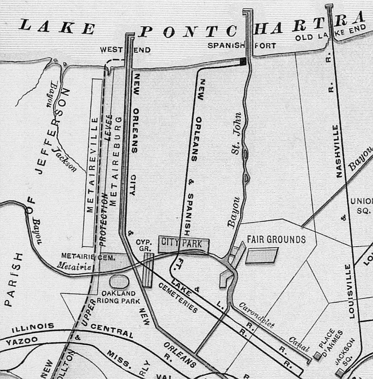
Weekly musical performances were provided at City Park by the New Orleans & Spanish Fort Railroad (whose route
is show on the map). An electric trolly extended a single track from the Halfway House at the New Basin Canal to the park.
Also here can be seen Bayou Jackson, Bayou Metairie, Metairieville, Metairieburg, Metairie Cemetery,
Oakland Riding Park, the New Orleans City & Lake Railroad route, the Carondelet Canal, the Fair Grouds, West End, Spanish
Fort, and the Old Lake End (Milneburg).