|
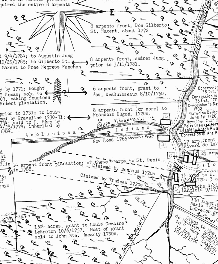
Copied and translated from a Spanish drawn map of 1798 we see that Metairie Road was named centuries ago. It was originally
referred to as Chemin de Tchoupitoulas, or "fish hole road". We also see that Bayou Metairie was known as Bayou
Tchoupitoulas. In fact, the entire Metairie area was originally called Tchoupitoulas. The map indicates a “new Road
1765” (Metairie Road) and the presence of “Acoloapissa Indians”. Bayou St. John runs north to south in this
illustration. Early land grants and concessions can also be seen here.
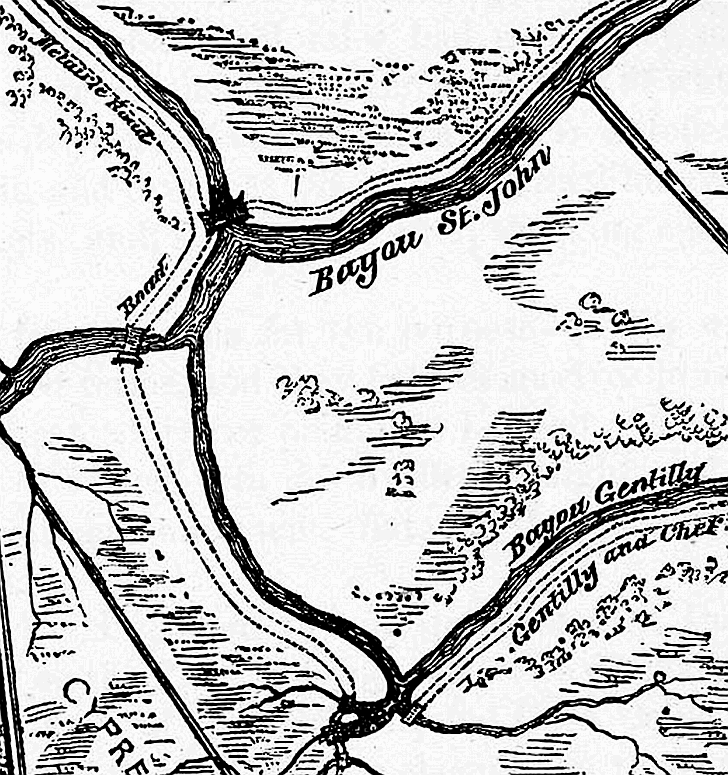
Below is another 1798 view of the Metairie Road, Metairie Bayou, Bayou St. John, and Bayou Gentilly.
 |