|
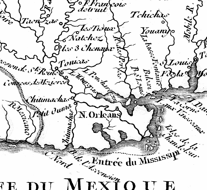
This
portion of a 1749 French colonial map entitled "Cours du Mississipi et La Louisiane" by Robert de Vaugondy shows
Native American tribe locations as well as Lake Pontchartrain and a primitive view of the east/west navigational "short
cut" between Gulf of Mexico and the lake. (Courtesy Louisiana Digital Library.)
 |