|
New Orleans Maps |
|
|
1845 City of Lafayette Boundaries
|
|||||||||||||||||||||||||||||||||||||||||||||||||||||||||||||||||||||||
|
Site Map
|
The Jefferson Parish City of Lafayette is outlined on 1845 map below. Jefferson City was bounded by Toledano Street, Melpomene
Street, Felicity Street, and the river – what we now call the Garden District and the Irish Channel, both of which have
been placed on the National Register of Historical Places. (Courtesy of the University of Tennessee Library.) 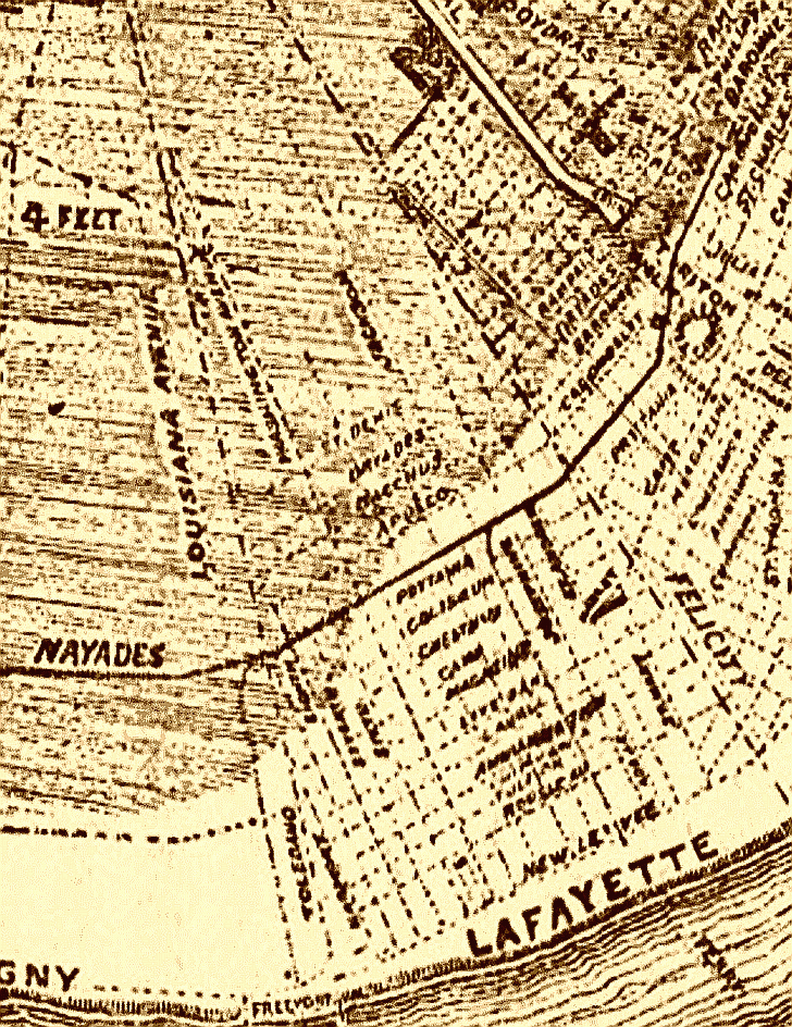
|
|
|||||||||||||||||||||||||||||||||||||||||||||||||||||||||||||||||||||
|
|
|||||||||||||||||||||||||||||||||||||||||||||||||||||||||||||||||||||||