|
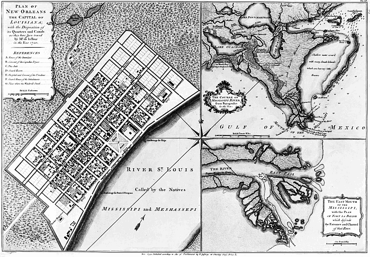
“The oldest street is probably Bayou Road. When the whites first intruded into Louisiana they found
it not altogether an untrodden wilderness. At the head of Bayou St. John, near the bridge which now spans that street at the
foot of Esplanade Street, stood an Indian village. The moccasined feet of the inhabitants of this tiny settlement had beaten
out a pathway by the shortest possible route through the swamps to the Mississippi...The white settlers found it a convenient
route; they appear to have used it frequently even before the site of New Orleans was definitely decided upon, and so it has
happened that later when new fauxbourgs were laid out it was a thoroughfare too well established to be changed, and it still
runs its ancient course, across lots and through squares” – from John Smith Kendall's History of New Orleans
(1922). This 1747 map shows the road to the bayou and the beginnings of the City of New Orleans.
 |